
UER-II Project Status 2026: How Delhi’s New Mega Highway is Slashing Commute Times
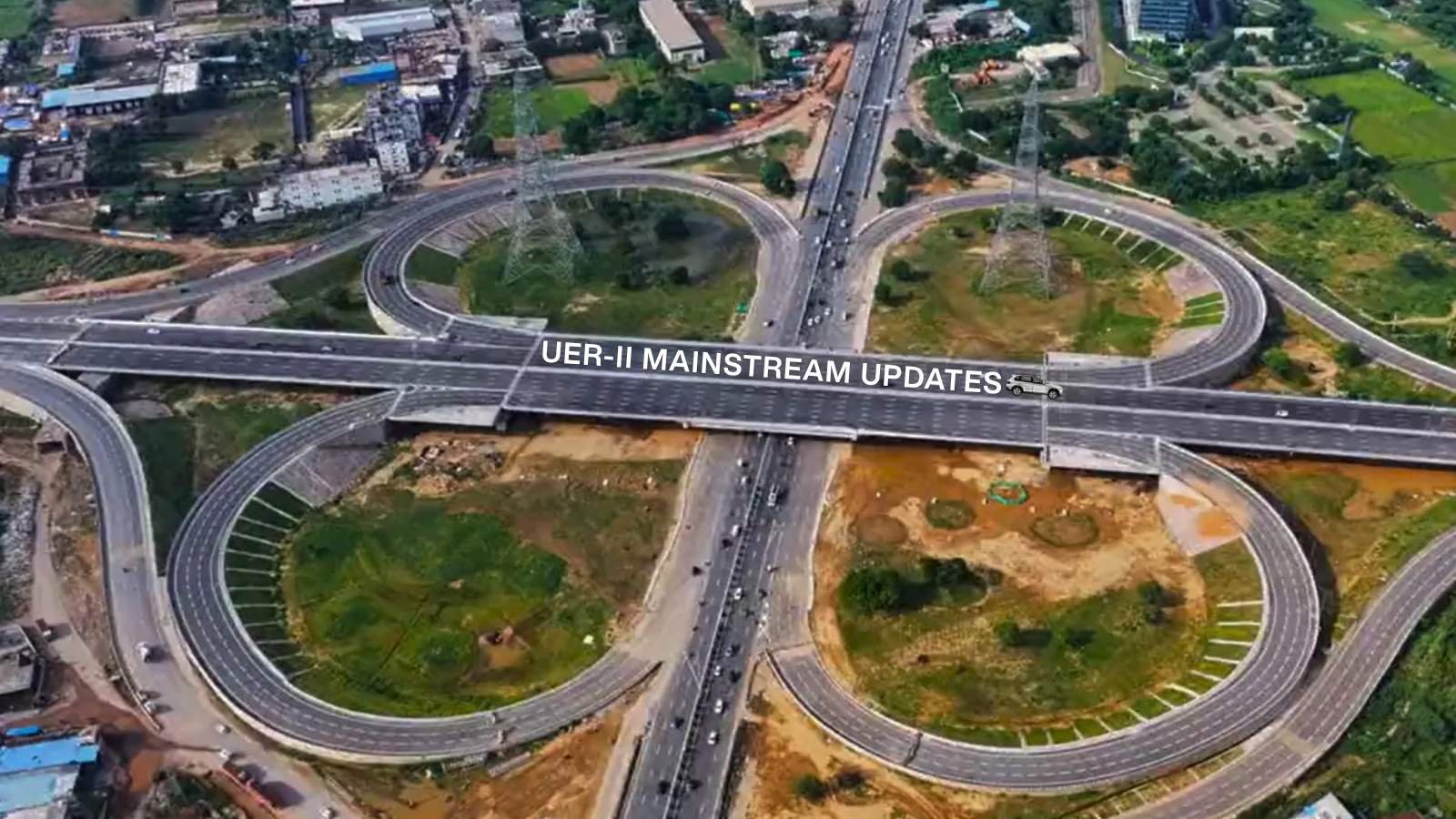
The wait is finally over for millions of commuters navigating the daily gridlock of the National Capital Region. Officially inaugurated by Prime Minister Narendra Modi on August 17, 2025, the Urban Extension Road-II (UER-II) is now fully operational as of early 2026.
Designated as National Highway 344M (NH-344M), this 76-kilometer, six-lane access-controlled expressway serves as Delhi’s third semi-Ring Road. By forming a massive western arc around the city’s borders, UER-II is successfully shifting daily traffic away from highly congested junctions like Azadpur and Peeragarhi, fundamentally transforming the way Delhi, Gurugram, and Haryana connect.
Here is the complete 2026 status update, route breakdown, and insider guide on how to navigate the new smart tolls.
The Route: Seamless Highway Connectivity
The main trunk of the expressway runs from Alipur in North Delhi all the way down to Mahipalpur on the Delhi-Gurgaon Expressway, where it merges seamlessly with the Dwarka Expressway.
This strategic alignment connects all major arterial highways entering the capital:
- NH-44: Delhi-Chandigarh-Amritsar Highway (at Alipur)
- NH-9: Delhi-Rohtak Highway (Major interchange at Mundka)
- NH-48: Delhi-Gurgaon-Jaipur Highway (at Mahipalpur)
Connected Feeder Spurs
In addition to the main arc, two major 4-lane feeder spurs extend UER-II’s reach deep into Haryana:
- Bawana-Sonipat Spur (NH-344P): A 29.6 km corridor connecting Northwest Delhi to the Barwasni Bypass in Sonipat.
- Najafgarh-Bahadurgarh Spur: A 7.3 km link connecting the Tikri-Najafgarh belt directly to the Bahadurgarh South Bypass on NH-9.
For daily commuters and frequent flyers, the travel time savings are staggering. A trip from Alipur or Sonipat to the Indira Gandhi International (IGI) Airport, which previously took upwards of 2.5 hours, has been slashed to just 30 minutes.
Eco-Friendly Infrastructure and Real Estate Boom
UER-II is not just an engineering marvel; it is one of India’s most significant green highway projects. The National Highways Authority of India (NHAI) utilized nearly 10 lakh metric tonnes of inert solid waste cleared directly from Delhi’s Bhalswa and Ghazipur landfills to construct the road’s base. Furthermore, over 10,000 mature trees were successfully uprooted and transplanted along the corridor. Looking ahead, authorities have also planned dedicated e-transit lanes for electric buses and trolleys along the route.
This massive infrastructure upgrade is also creating a ripple effect across the real estate sector. The Delhi Master Plan 2047 has designated a 20-square-kilometer zone along the expressway as a High-Density Corridor for mixed-use and commercial activities.
Micro-markets in Rohini (Sectors 34-38) and Dwarka (Sectors 24-26)—areas already seeing lifestyle upgrades like the newly launched DDA Golf Course Dwarka—are positioned directly adjacent to UER-II entry ramps. Similarly, housing demand in Northwest Delhi is surging, complementing the massive uptake of the new DDA Nagrik Awaas Yojana flats in Narela. Property values in these belts have already seen a noticeable 20% to 30% uptick since the highway became fully operational.
Smart Tolling: How to Save Money with the Digital Local Pass
If you are planning to drive on UER-II, be prepared for a futuristic transit experience. The expressway utilizes a Multi-Lane Free-Flow (MLFF) Barrier-Free Automatic Tolling System at the primary Mundka-Bakkarwala Toll Plaza. AI-powered cameras and RFID gantries scan your vehicle at highway speeds, automatically deducting the standard Rs 235 one-way toll for private cars from your linked FASTag wallet.
However, if you are a local resident, you do not have to pay the standard rate. The NHAI offers a highly discounted Digital Local Pass for just Rs 350 per month, granting unlimited crossings.
Step-by-Step Guide to Applying for the Local Pass
To qualify, your private vehicle must have a functional FASTag, and your registered DigiLocker address must fall within a 20-kilometer radius of the Mundka-Bakkarwala toll zone.
- Download the App: Install the official NHAI Rajmargyatra App on your smartphone.
- Select the Local Pass Option: Log in with your mobile number and select the Local Pass facility from the main dashboard.
- Choose the Plaza: Select the Mundka-Bakkarwala Toll Plaza (NH-344M/UER-II).
- Authorize Digital Verification: Grant the app consent to connect with DigiLocker and the VAHAN database. The system will automatically verify if your residential address is within the 20 km radius.
- Pay and Activate: Once approved, pay the Rs 350 monthly fee. The pass links directly to your FASTag ID, allowing you to drive through the automated gantries without per-trip deductions.
Speed Limits, Challan Rates, and Camera Locations
Because UER-II is built to international expressway standards, it is tempting to drive at high speeds. However, the Delhi Traffic Police and NHAI enforce strict speed monitoring using advanced Over Speed Violation Detection (OSVD) systems equipped with 360-degree rotatable 4D radar interceptors. These radar gantries track vehicle speeds from up to 300 meters away and automatically issue digital e-challans.
The legal speed limit on UER-II is strictly 100 km/h for private cars and 80 km/h for commercial vehicles.
Speeding Penalty Breakdown (Motor Vehicles Act)
Under Section 183 of the Motor Vehicles Act, automated speed violations trigger the following penalties:
- Private Cars (LMV): Rs 2,000 for the first offense.
- Commercial Vehicles (MMV/HTV): Rs 4,000 for the first offense.
- Repeat Offenses: A second overspeeding violation increases the fine to Rs 4,000 for cars, accompanied by the immediate seizure and a mandatory minimum three-month suspension of your driving license.
- Dangerous Driving & Racing: Performing high-speed maneuvers or racing triggers an automated Rs 5,000 penalty.
Primary Speed Camera Locations on UER-II
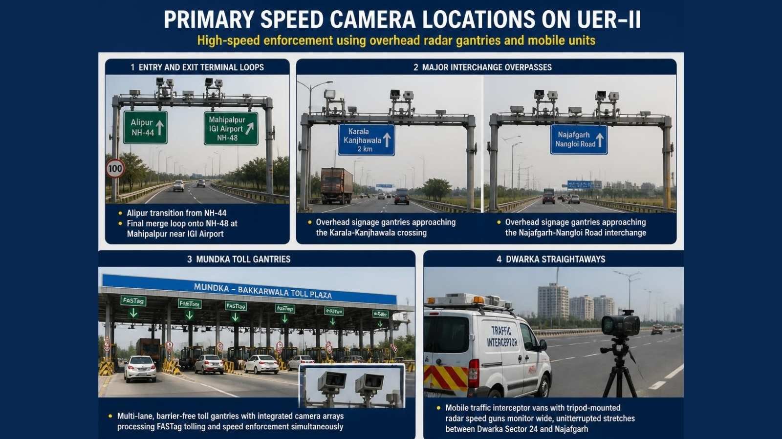
Instead of traditional static cameras, enforcement relies on high-speed overhead radar gantries and mobile units positioned along key stretches:
- Entry and Exit Terminal Loops: Heavy radar units are positioned at the Alipur transition from NH-44 and the final merge loop onto NH-48 at Mahipalpur near the IGI Airport.
- Major Interchange Overpasses: Overhead signage gantries approaching the Karala-Kanjhawala crossing and the Najafgarh-Nangloi Road interchange house active radar sensors.
- Mundka Toll Gantries: The multi-lane, barrier-free toll gantries at Mundka-Bakkarwala feature integrated camera arrays that simultaneously process FASTag tolling and speed enforcement.
- Dwarka Straightaways: Mobile traffic interceptor vans equipped with tripod-mounted radar speed guns frequently monitor the wide, uninterrupted stretches between Dwarka Sector 24 and Najafgarh.
Commuter Reach Time Table: The UER-II Impact
For daily commuters and logistics fleets, UER-II has fundamentally altered the geography of the National Capital Region. By bypassing the choked Inner and Outer Ring Roads, the new highway cuts cross-city travel times by more than half.
| Origin Location | Destination | Old Travel Time | New UER-II Time |
| Alipur / Sonipat Border | IGI Airport (Terminal 3) | 2 to 2.5 Hours | 30 Minutes |
| Rohini / Bawana | Dwarka Sector 24 | 1.5 Hours | 20 Minutes |
| Najafgarh / Mundka | Gurugram (NH-48) | 1.5 Hours | 25 Minutes |
| Noida (via integrated expressways) | IGI Airport (Terminal 3) | 1.5 Hours | 30 Minutes |
The 5.1 km Airport Tunnel: Rules and Restrictions
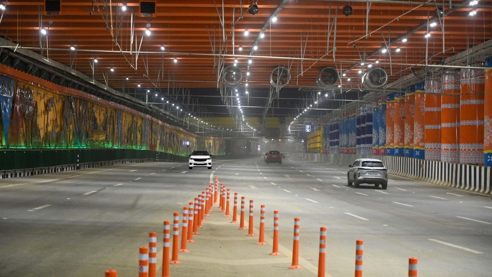
One of the most critical engineering feats on the southern end of UER-II and the Dwarka Expressway is the 5.1 km Airport Tunnel. This shallow, 8-lane underground complex runs directly beneath the main aircraft airstrip, linking the western arc of Delhi directly to the Indira Gandhi International (IGI) Airport (Terminal 3) and NH-48 at Shiv Murti.
The complex features a 3.6 km main tube leading straight to the T3 airport gates, along with a 1.5 km side loop branching off towards Gurugram. However, because the tunnel traverses highly secure airport territory, the traffic rules are incredibly strict:
- Vehicle Restrictions: The tunnel is strictly reserved for four-wheelers and commercial cars. Two-wheelers (motorcycles, scooters) and three-wheelers (auto-rickshaws) are completely banned from entering.
- Height Limits: Vehicles must be under 4.5 meters tall. Large multi-axle commercial trucks cannot use this route.
- Hazardous Cargo Banned: Any commercial vehicles carrying inflammable items, fuel, or hazardous materials are strictly forbidden from entering the underground complex.
The Future: Vasant Kunj Extension (NH-148AE)
The infrastructure boom is not stopping at the airport. The Union Cabinet has approved a massive extension to this underground system to further decongest South Delhi.
Designated as NH-148AE, a new 8.1 km, 6-lane twin-tube underground tunnel will be constructed. It will pick up exactly where UER-II and the Dwarka Expressway meet at the Shiv Murti interchange, digging straight beneath the protected Rangpuri Southern Ridge forest, and emerging at Nelson Mandela Marg in Vasant Kunj.
This future extension will allow travelers driving down UER-II from North Delhi, Sonipat, or Dwarka to remain completely underground, bypassing the notorious Mahipalpur surface traffic and exiting seamlessly into South Delhi.
Emergency Contacts on UER-II
- NHAI Emergency Highway Helpline: 1033 (24×7 Ambulance, Crane, and Patrol Assistance)
- Delhi Emergency Services: 112
SEO & Publishing Metadata
- Meta Title: UER-II Project Status: How Delhi’s New Mega Highway Slashes Commute Times
- Meta Description: The 76-km UER-II (Urban Extension Road 2) is fully operational. Read our complete guide on the route map, travel times, and how to get the Rs 350 local toll pass.
- Suggested Image Alt-Text: Aerial view of the six-lane Urban Extension Road-II (UER-2) expressway in Delhi connecting to the IGI Airport.
This video provides ground coverage showing how the Bahadurgarh spur integrates with the main UER-II highway loop to improve regional connectivity.
